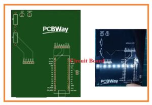
 Hello, friends welcome to the new post. In this, we will have a detailed look at GPS Tracker using Arduino. The Arduino is is the most famous and controller provider software with hardware manufacturer companies. Its main products are microcontrollers having one board with that controller kits that are used for the creation of digital instruments. Hardware elements of this company are supported to the CC_BY-SA license and software is supported to the GPL.
In this post, we use this controller to make a project that involves to the GPS tracker and discuss circuitry and practical use. Here we are using Arduino due to its simple construction and easy-to-handle capability. Here we are using PCB board to design the assembly of these projects that can be easily handled and manufactured than the other wiring complicated circuitry construction technique that offers a high chance of error. The PCB used in this project is getting through the most reliable and trustable PCB manufacturer that offered high-quality PCB to their customers at reasonable prices. That is PCBWAY the feature of this PCB discussed in the coming lines and about the service that we get from them. So let get started.
What is GPS
- The GPS stands for global positioning system also called Navistar GPS which is controlled through the satellite and monitored by the US and functioned by the US space agency.
- Through this system, we can determine the position. time and other related data at the receiver point at any location of the world.
- There is no need of any data transmission device for this system its operate on its own through the usage of the internet or electronic device like mobile phones laptops, etc.
- It is helpful for the different fields of life like military uses, civilian purposes and different projects based uses all over the world.
- This network was created by the government of the USA and resolves any fault that occurs on it and can be accessed by any users all over the world
- This system first time was introduced through the USA defense in 1972 and the first time twenty-four satellite was launched to run the system in 1993.
- At its creation time was used by military purposes of the USA was become for common use of people in after 1980.
- With the passage of time, the advancement of technology occurred making this system most reliable and fast with offering new technology to the world like GPS Block IIIA.
- Currently, almost all smartphones consist of this system through that use we can find our location and positions on a mobile phone.
- Here we discuss how we can make this system through the usage of the Arduino module.
- We discuss this project with detail and its working accurately.
- To get the different parameters like time. latitude, longitude position, and other terms you just has to link GPS to the desktop or laptop computer.
- For enhance the higher accuracy of results there is a need or more than 3 satellites but for normal understanding three satellites are enough.
- Let’s now come ot our project and see how we can create it.
First of discussed the features of PCB board used in this project.
PCB Features
- This PCB board is designed by PCBWAY that is china based PCB manufacturer that offered different services related to PCB boards and their related types at one place also offered PCB designing services at affordable prices.
- FR-4 substances is used by this manufacturer as the base material of PCB. Here we designed a single-sided PCB board that offered a high value of heat resistance from heat dissipation.
- The solder mask color is black with good quality and offers protection for copper traces to get a short circuits.
- All the requirements that we asked them to add in our design they fulfilled and send me on given time interval.
Projects Components
- The details of the component used in this circuitry are mentioned here.
- PCB board created by the PCBWAY
- Arduino
- GPS GT-7U
- LED
- Resistances
GPS Tracker using Arduino
- In the below diagram, you can see the simulation of this project and the connection configuration of the board.
- Here is the main component is Arduino nano that is controlling our circuit and helping to find the values of different parameters through the use of GPS like our position, time, and other parameters.
- Here I also have created a block diagram of a circuit that will help you to make a practical understating of this project.
So that is a detailed post about GPS Tracker using Arduino i have covered each and every parameter related to this project. If you still have any queries ask in the comments thanks for reading. Have a nice day.


